Bookmark the permalink.


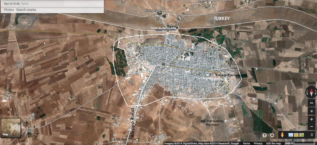
Labeled overhead map of Kobani / Ayn Al-Arab, Syria, October 5, 2014. Click map to see a topographical rendering of the hill or click here to navigate in Google Maps.
1 of 3: On October 5, ISIS forces captured the southeastern hill overlooking Kobani and breached the town entrance below it (see full article) as shells rained down inside the town. Fresh U.S. airstrikes the same day appeared to have almost no effect. Syrian Kurdish YPG/YPJ resistance fighters continue to fiercely defend every meter of land, as block-by-block fighting began on the southeast. On the other side of the town, ISIS siege forces continue to tighten the noose and are still pressing up the Aleppo Road to the southwest entrance.