Bookmark the permalink.


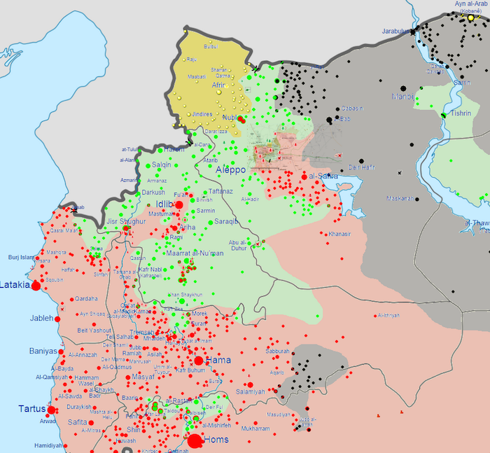
A map of government territory in northwestern Syria as of October 7, 2014. (Red = government, gray = ISIS, yellow = Syrian Kurds, green = other rebels.) Map via Wikimedia
After the fall of Homs in May 2014, government forces in western Syria have made steady progress northward toward Aleppo and the shrinking zone of rebel control. ISIS has been moving in from the east, as well. [More: “Assad’s air power returns to west Syria, as US handles east”]